Catalog Archive
Auction 116, Lot 285

"Territory of New Mexico", General Land Office
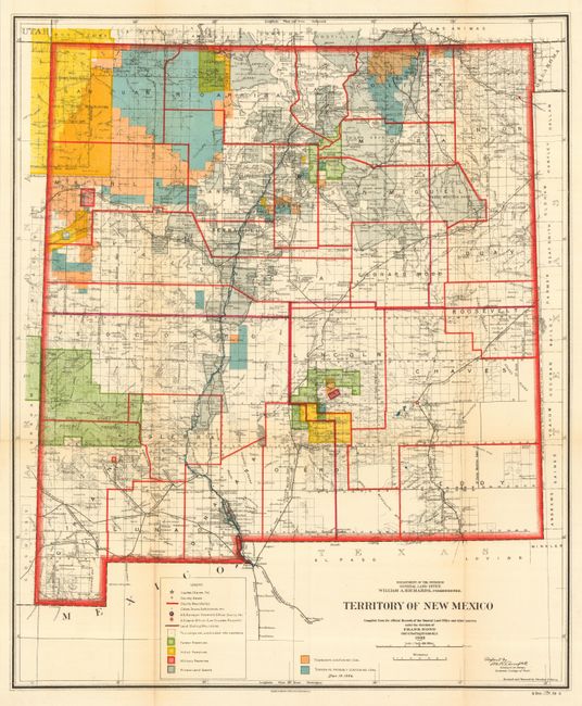
Subject: New Mexico

Period: 1903 (dated)

Publication: Sen Doc 194, 59th Cong., 2nd Sess.

Color: Printed Color

Size:
18 x 22 inches
45.7 x 55.9 cm
Download High Resolution Image
(or just click on image to launch the Zoom viewer)

This colorful and fascinating map with great detail was published only nine years before New Mexico obtained statehood. The extent of existing Indian reservations, Military reservations, Forest Reserves and Private Land Grants is shown through color and hash. Townships containing coal or probably containing coal are also colored, combining to provide great visual impact. The map is filled with information on watershed, mountains, railroads, wagon roads, unsurveyed townships, etc. In 1903, Guadalupe county was renamed Leonard Wood and then returned to Guadalupe in 1905. This is the only map we are aware of that shows that short-lived county of Leonard Wood. The map was compiled by Frank Bond, Chief of Drafting Division. Signed in the plate "M.R. Campbell, Geologist in charge, Economic Geology of Fuels," and revised by Charles J. Heim to December 19, 1906.

References:

Condition: B

Beautiful impression and coloring with original margins. Slightly toned along two folds, else fine. Issued folding, this example is flat and backed with archival tissue.

Estimate: $150 - $180

Sold for: $110

Closed on 9/20/2006

Archived