Catalog Archive
Auction 116, Lot 248

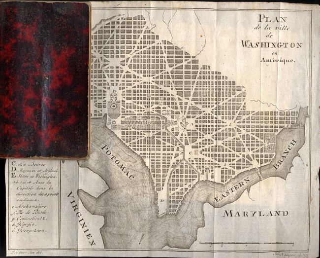
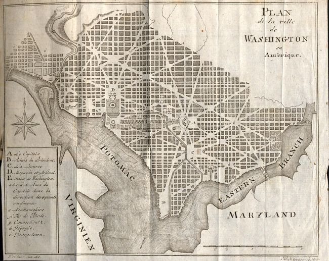
"Plan de la ville de Washington en Amerique", Klinger, Johann George

Subject: District of Columbia

Period: 1794 (dated)

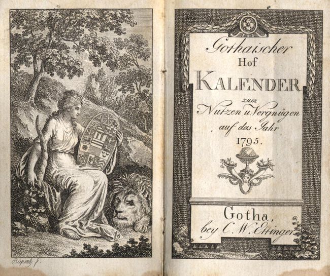
Publication: Gorhaischer Hof Kalender

Color: Black & White

Size:
7.7 x 6.3 inches
19.6 x 16 cm
Download High Resolution Image
(or just click on image to launch the Zoom viewer)

This rarely seen map is bound into a small German calendar book. All streets and boulevards are shown, but unnamed. Legend at left names and locates the Capitol, President's House, La Bourse, the Arsenal, the Washington Monument, and Georgetown. The map follows Thackara & Vallance after Andrew Ellicott's plan. Phillip's reference suggests this is the first German-produced plan of the city. It is bound near the front of the fine little booklet by C.W. Ettinger, published in 1795. It contains numerous other engraved views and portraits. The first two portraits, "Louise Auguste Wilhemine Amalie, Kronprinzessin von Preussen" and "Friederike Karoline Sophie Alexandrine, Prinzessin von Preussen" are beautifully etched rather than engraved. They are finely rendered with beautiful texture from the flakes of acid-resisting 'ground' applied to the plate by the skilled etcher. The book (2.5" x 4") is bound in red marbled paper, frontispiece, title, roughly 300 pages, map, numerous plates, and blank calendar pages by month at back. Gilt edges on all three sides.

References: Phillip's Maps and Views of Washington and District of Columbia, PW:31.

Condition: A

Contents, plates and map are clean with just a thin, light line of water stain along bottom margin of some pages. Covers with typical rubbing and a little abrasion through marbling along spine.

Estimate: $250 - $300

Sold for: $1,100

Closed on 9/20/2006

Archived