Catalog Archive
Auction 116, Lot 23

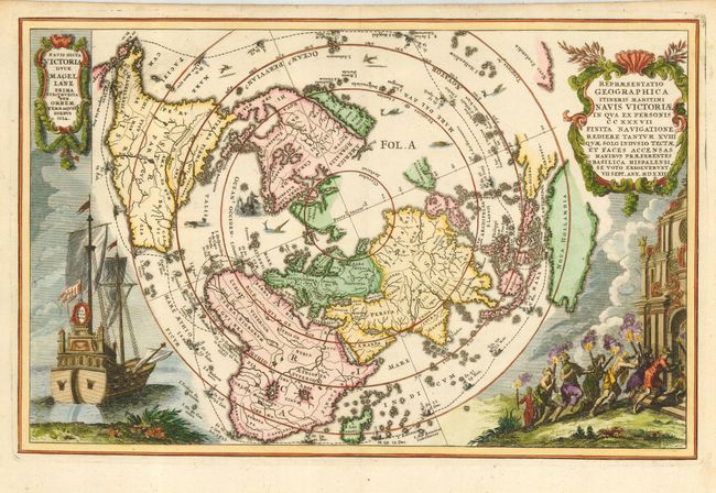
"Repraesentatio Geographica Itineris Maritimi Navis Victoriae…", Scherer, Heinrich
Subject: World

Period: 1700 (circa)

Publication:

Color: Hand Color

Size:
14 x 9 inches
35.6 x 22.9 cm
Download High Resolution Image
(or just click on image to launch the Zoom viewer)

This is a very graphic map of the world presented on a north polar projection. This map is from the series produced by Scherer who was a mathematics professor and devout Jesuit. California is shown as an Island and the track of Magellan's voyage around the world is noted. At left is a beautiful engraving of Magellan's ship Victoria.

References: Shirley #626.

Condition: A+

Remnants of paper hinges on verso.

Estimate: $1,500 - $1,700

Sold for: $1,100

Closed on 9/20/2006

Archived