Catalog Archive
Auction 116, Lot 232

"Monterey Harbor", U.S. Coast Survey
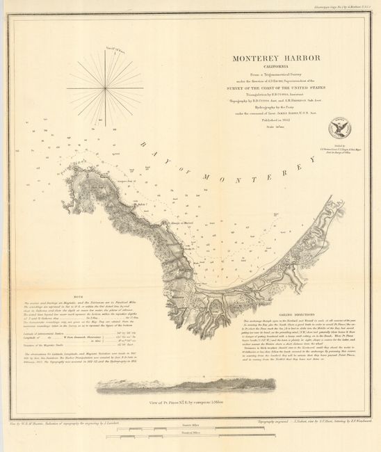
Subject: California

Period: 1852 (dated)

Publication:

Color: Black & White

Size:
11.8 x 13 inches
30 x 33 cm
Download High Resolution Image
(or just click on image to launch the Zoom viewer)

Great chart from this important coastal survey of Monterey Bay that has a plan of the town and fort. The church, custom house, ruins of a fortified Mexican battery, Point Pinos, Pt. Anlon, Pt Almejor Mussell, the Lagoon, and the cemetery are located. It extends to Point Pinos, now the location of Pacific Grove and part of the famous 17 Mile Drive, with a small offshore view of Pt. Pinos across the bottom. The chart includes extensive sailing directions, a simple compass rose, two distance scales, and the official seal of the Coast Survey Office.

References:

Condition: A

Folding as issued. Full, original margins, hint of toning at one fold with lazy crease at edge.

Estimate: $140 - $180

Sold for: $100

Closed on 9/20/2006

Archived