Catalog Archive
Auction 116, Lot 217

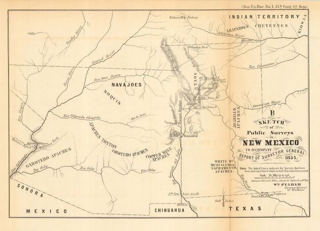
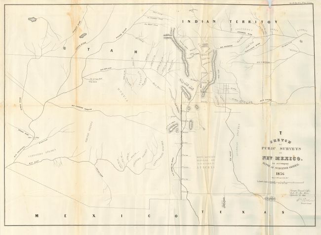
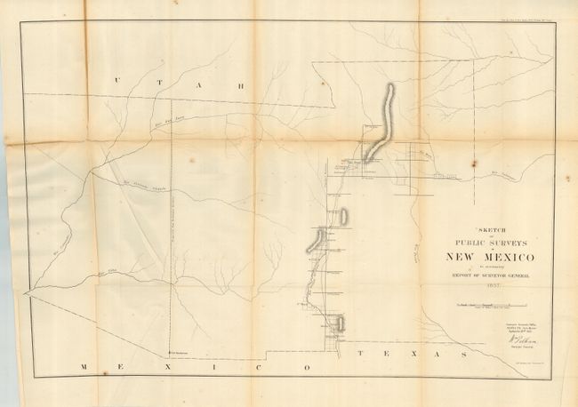
"[Lot of 3] Sketch of Public Surveys in New Mexico to Accompany Report of the Surveyor General [1855, 1856 & 1857]", General Land Office

Subject: Southwestern United States, New Mexico, Arizona

Period: 1855-57 (dated)

Publication:

Color: Black & White

Size:
See Description
Download High Resolution Image
(or just click on image to launch the Zoom viewer)

Terrific lot for the Arizona & New Mexico collector that features the first three maps created to describe the progress of surveys in the nascent New Mexico Territory. All share the title as given above. The 1855 edition (7.3 x 10.5") is only the fourth map issued by the General Land Office. Wheat calls this a sketch but notes that it "is a beginning on the rough job of surveying the western states and territories." Sen. Ex. Doc. No. 1, 34th Congress, 1st Session. Toned along fold, else very good. The 1856 & 1857 edition are the same size (22.5 x 30"), but are completely different maps. Both are large-scale maps that show the territory in its fullest extent including all of present-day Arizona and parts of Nevada and Colorado. Also, both locate numerous Indian villages and reservations with very limited detail outside of the towns along the Principal and Guide Meridians. The 1856 map expands slightly on the first public surveys of 1855 with the addition of three small surveys completed east of Santa Fe. Sen. Ex. Doc. No. 5, 34th Congress, 3rd Session. Water stain along one fold, creased, small loss at top affecting border. The 1857 map adds survey information near Socorro and Cruces and Mesila. Sen. Ex. Doc. No. 5, 34th Congress, 3rd Session. Toned along folds with a some splitting in one area, some closed on verso with archival tape.

References: 1) Wheat [TMW] #854.

Condition: B

All are folding, as issued. See description for additional condition notes.

Estimate: $120 - $180

Sold for: $60

Closed on 9/20/2006

Archived