Catalog Archive
Auction 116, Lot 170

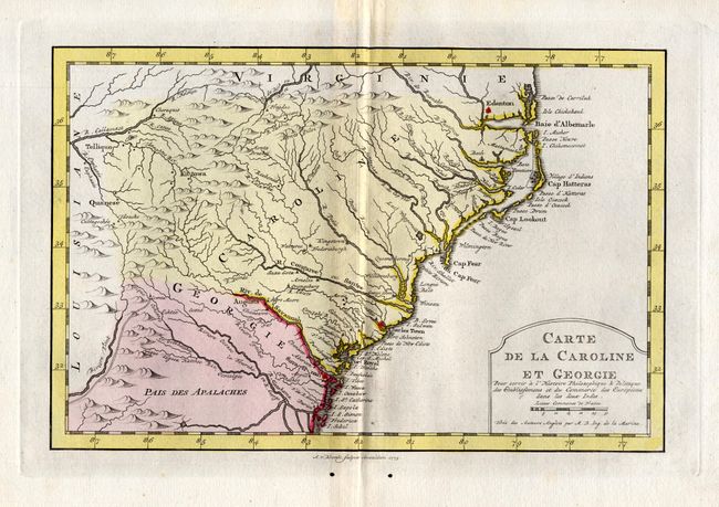
"Carte de la Caroline et Georgie", Bellin, Jacques Nicolas

Subject: Colonial Southeast

Period: 1773 (dated)

Publication: l'Histore Philosophique & Poltique des Establisements et du Commerce des Europe

Color: Hand Color

Size:
11 x 7.3 inches
27.9 x 18.5 cm
Download High Resolution Image
(or just click on image to launch the Zoom viewer)

Delicately engraved map depicts the colonies from Albemarle Sound to the Alatamaha River. It probably owes its origin to the 1752 map of the region by Emanuel Bowen. Numerous English settlements along the coast and Indian villages are located throughout, including a number west of the Appalachian Mountains. There is more detail in the area west of the Blue Ridge than in many other maps of the period. The map shows a rudimentary course of the Tennessee River in the western section of the map. Title cartouche incorporates the distance scale. This is a Dutch edition of Bellin's map, dated 1773 and engraved by A. v. Krevelt.

References: cf Cummings (SE) #311; cf Sellers & van Ee #1384.

Condition: A

Good impression, wide margins and very nice full wash coloring. A little light surface soil at lower center in the Atlantic and a pair of worm holes in lower margin.

Estimate: $300 - $400

Sold for: $220

Closed on 9/20/2006

Archived