Catalog Archive
Auction 116, Lot 164

"Luigiana Inglese, colla Parte Occidentale della Florida, della Giorgia, e Carolina Meridonale", Zatta, Antonio

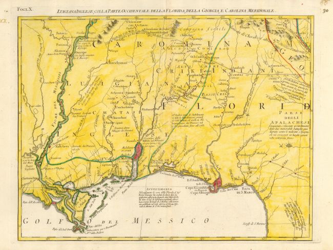
Subject: Colonial South

Period: 1778 (published)

Publication: Atlante Novissimo

Color: Hand Color

Size:
16.5 x 12.5 inches
41.9 x 31.8 cm
Download High Resolution Image
(or just click on image to launch the Zoom viewer)

This map is a great regional map that shows New Orleans and details the Gulf Coast to Florida, and the valley of the Mississippi River north above Akansa and Po. Ozier. It also details Mobile Bay and the course of the Albama river and tributaries. The prominent trading route in the north nearly reaches the Mississippi River and even marks distances between important points. The map extends to show the region of Capo S. Biagio and the course of the Apalachicola River. The map is sheet X from Zatta's Le Colonie Unite dell' America Settentrle, which is often referred to as the Italian edition of John Mitchell's map, on which it is based. Zatta's maps retain Mitchell's scale, but being smaller are more legible. Zatta also included updated legends (in Italian) with notations concerning the Revolutionary War.

References: Portinaro & Knirsch #152; Sellers and Van Ee #163.

Condition: B

Minor abrasion in a small area east of Mobile Bay and a small pair of wormholes near upper neatline. Printed on thick hand laid paper with original margins. Later full wash coloring in yellow added to the original outline color.

Estimate: $425 - $500

Sold for: $375

Closed on 9/20/2006

Archived