Catalog Archive
Auction 116, Lot 132

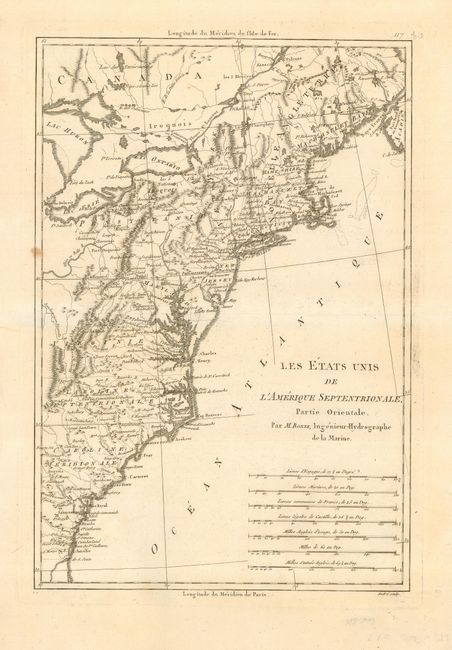
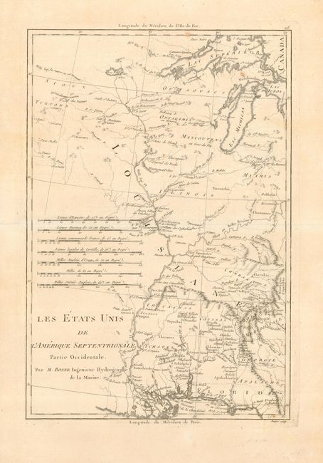
"[Lot of 2] Les Etats Unis de l'Amerique Septentrionale, Partie Occidentale [together with] … Partie Orientale", Bonne, Rigobert

Subject: Eastern United States

Period: 1787 (circa)

Publication: Atlas Encyclopedique

Color: Black & White

Size:
9 x 14 inches
22.9 x 35.6 cm
Download High Resolution Image
(or just click on image to launch the Zoom viewer)

Matched pair of maps covering the territory of the newly created United States. Partie Orientale covers the eastern seaboard from New England to the coast of Georgia. Partie Occidentale shows the territory from the Appalachian Mountains to the Mississippi River. The southern states are shown with their western boundaries on the Mississippi River. Early settlements, frontier forts, missions, mines, Indian villages, as well as some trails and portages are revealed in great detail. Both with seven distance scales.

References: Eastern sheet, McCorkle #788-1; Western sheet, Sellers and Van Ee #794.

Condition: A

Both with wide margins on thick, hand laid paper with deckled edges and watermarks. One light spot in left border of eastern sheet, one soft crease, and a few insignificant marginal flaws.

Estimate: $400 - $500

Sold for: $400

Closed on 9/20/2006

Archived