Catalog Archive
Auction 116, Lot 118

"United States", Robinson, D.F. & Co.

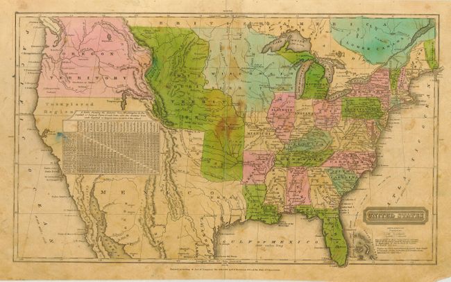
Subject: United States

Period: 1835 (circa)

Publication: Olney's School Atlas

Color: Hand Color

Size:
16.8 x 10 inches
42.7 x 25.4 cm
Download High Resolution Image
(or just click on image to launch the Zoom viewer)

This great map of the United States has early and interesting western territorial configurations. The map shows Texas as part of Mexico, just prior to it becoming a republic in 1836. The northern portion of Upper California is marked Unexplored Region, with much of the Southwest conveniently covered by a table of distances. The huge Oregon Territory extends to the Continental Divide and well north into British America, suggesting the U.S.'s early interest in claiming this region. East of Oregon is the large and convoluted Missouri Territory that stretches between the Canadian border down to Texas. A large Wisconsin Territory extends from the Missouri River to the Great Lakes. The map is filled with information on forts, Indian tribes, waterways, and more. Copyrighted date of 1828 by D.R. Robinson, but published circa 1835. Despite the only fair condition, this map shows well.

References:

Condition: C

Original coloring, good impression, full margins and sound paper. Overall age toned with some darker stains near center and general surface soil. Some tape repaired fold separations. Pencil scribbles on verso that do not show through.

Estimate: $100 - $140

Sold for: $190

Closed on 9/20/2006

Archived