Catalog Archive
Auction 116, Lot 115

"L'Acadia, le Provincie di Sagadahook e Main, la Nuova Hampshire, la Rhode Island, e Parte di Massachusset e Connecticut", Zatta, Antonio

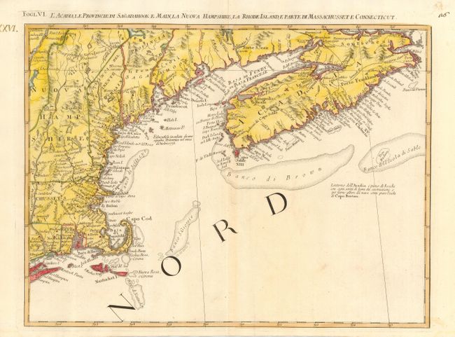
Subject: Colonial United States and Canada

Period: 1778 (published)

Publication: Atlante Novissimo

Color: Hand Color

Size:
16.7 x 12.5 inches
42.4 x 31.8 cm
Download High Resolution Image
(or just click on image to launch the Zoom viewer)

This great regional map covers New England and Nova Scotia and details the early settlements and roads with the adjacent fishing banks. It includes Cape Cod, Boston, Newport, New London, Portsmouth, and much more. This map is one sheet of the Italian edition of Mitchell's seminal map of the British Dominions in North America that Zatta issued in 12 sections with the whole titled "Le Colonie Unite dell' America Settentrle." Towns, villages, roads, trails, and watershed topography were drawn from the earliest available English and indigenous surveys. Block titling above neatline. The map was also included in the Italian edition of Abbe Raynal's "Storia dell' America Settentrionale."

References: Kershaw #796; McCorkle #778.8; Portinaro & Knirsch #148; Sellers and Van Ee #163.

Condition: A

Printed on thick hand laid paper with two watermarks. Later full wash coloring in yellow added to the original outline color.

Estimate: $300 - $400

Sold for: $400

Closed on 9/20/2006

Archived