Catalog Archive
Auction 115, Lot 92
"Novus Orbis sive America Meridionalis et Septentrionalis, per sua Regna, Provincias, et Insulas iuxta Observationes et Descriptiones Recentiss", Seutter, Matthias
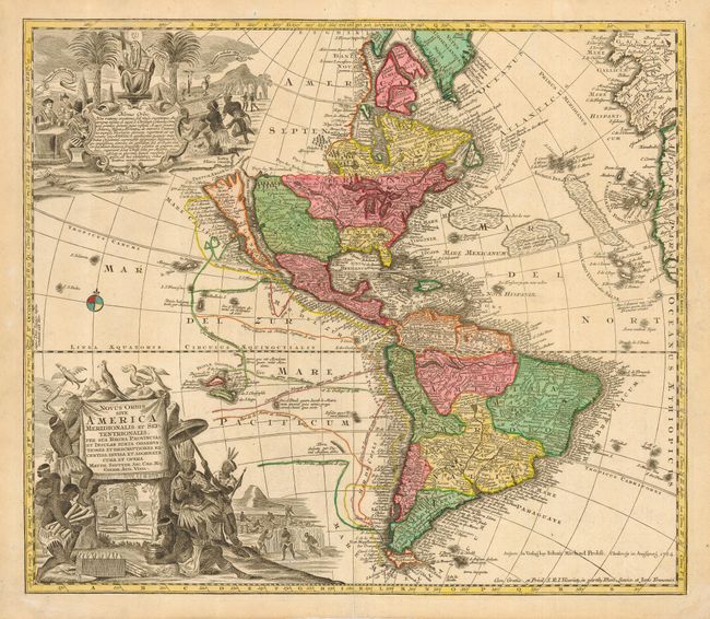
Subject: Western Hemisphere
Period: 1784 (dated)
Publication:
Color: Hand Color
Size:
22.8 x 19.5 inches
57.9 x 49.5 cm
Download High Resolution Image
(or just click on image to launch the Zoom viewer)
(or just click on image to launch the Zoom viewer)