Catalog Archive
Auction 115, Lot 706

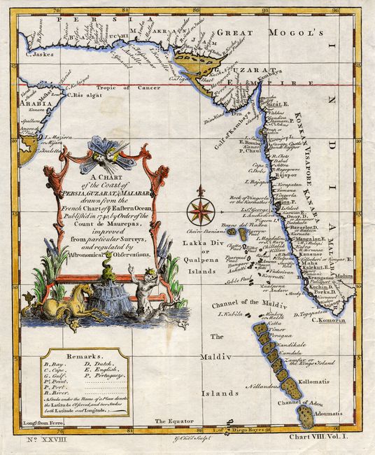
"A Chart of the Coast of Persia, Guzarat, & Malabar drawn from the French chart of ye Eastern Ocean published in 1740 by order of the Count de Maurepas, improved from particular Surveys and regulated by Astronomical Observations", Anon.

Subject: Maldives, Indian Ocean

Period: 1752 (circa)

Publication: Universal Traveller

Color: Hand Color

Size:
7.7 x 9.4 inches
19.6 x 23.9 cm
Download High Resolution Image
(or just click on image to launch the Zoom viewer)

An attractive copper engraved chart centered on the Arabian Sea. Shows some of the Persian Gulf and the Gulf of Oman, extending past Persia to include half of India. Locates the Maldives and many offshore islands and details capes, shoals, bays, and major harbors. Decorative rococo-style title cartouche features sea-serpents, a fountain, sea-horse, water nymph, and two wind heads. Compass rose with fleur-de-lys at center. This map was finely engraved by G. Child and carries the page number XXVIII.

References:

Condition: A

Strong impression on hand laid paper. Later hand coloring. Two light spots in blank ocean, still very good.

Estimate: $100 - $140

Sold for: $110

Closed on 6/21/2006

Archived