Catalog Archive
Auction 115, Lot 369

"Romani Imperii qua Occidens est Descriptio Geographica", Sanson, Nicolas

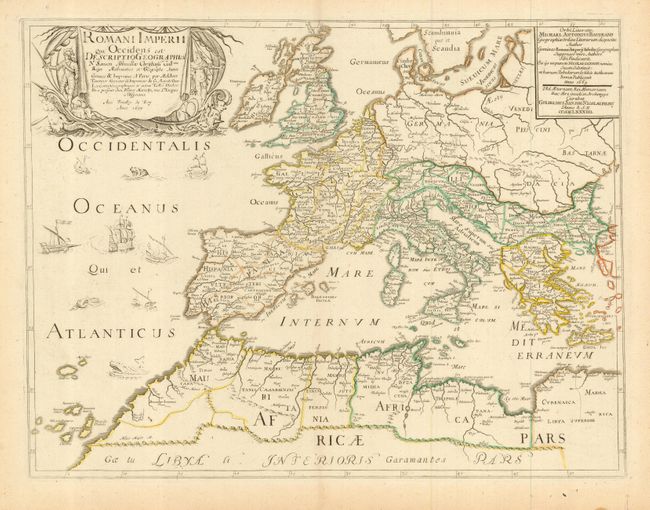
Subject: Roman Empire

Period: 1637 (dated)

Publication: Les Cartes Générales de toutes

Color: Hand Color

Size:
20.3 x 15.3 inches
51.6 x 38.9 cm
Download High Resolution Image
(or just click on image to launch the Zoom viewer)

Finely engraved copper plate map of the Roman Empire. Includes Europe, Northern Africa, and the Near and Middle East. The map is embellished with ships in the Atlantic and a fine title cartouche featuring figures, ships and figurehead. The map was first published by Tavernier and later by Mariette. This edition is dated 1637 with the address of Pierre Mariette at rue S. Jacques a l'Esperance. A nice example of this chart.

References:

Condition: A

Light impression on a full sheet of hand laid paper with full, original margins. Original outline coloring. Professionally encapsulated in archival Mylar.

Estimate: $140 - $180

Sold for: $100

Closed on 6/21/2006

Archived