Catalog Archive
Auction 115, Lot 287

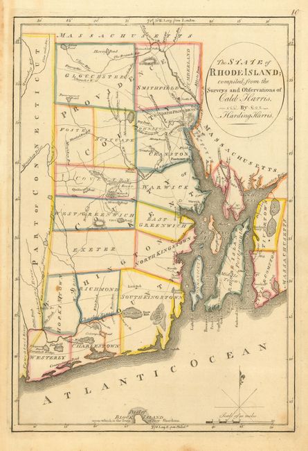
"The State of Rhode-Island; compiled from the Surveys and Observations of Caleb Harris", Carey, Mathew
Subject: Rhode Island

Period: 1795 (published)

Publication: Carey's General Atlas

Color: Hand Color

Size:
9.4 x 13.6 inches
23.9 x 34.5 cm
Download High Resolution Image
(or just click on image to launch the Zoom viewer)

A fascinating and early look at the state that details roads, bridges, ferries, villages and cities, rivers, ponds, township and county boundaries. Shows a portion of Block Island. Features a small block plan of Providence, all of Narragansett Bay with Conanicut Island and a smaller block plan of Newport. Locates Warren, Pawtuxet, North Kingstown, Mt. Hope and Mt. Hope Bay, Prudence Island and Pt. Judith at the entrance to the Bay. With a simple compass rose and fleur-de-lys with mileage scale below. This boldly engraved chart was drawn by Harding Harris. An early and desirable map produced in the America's.

References: Phillips (A) #1372-10

Condition: A

Dark impression on a full sheet with deckled edge. A couple insignificant spots, still very good. Lightly toned along left margin from binding strap, outside map image.

Estimate: $200 - $300

Sold for: $180

Closed on 6/21/2006

Archived