Catalog Archive
Auction 115, Lot 275
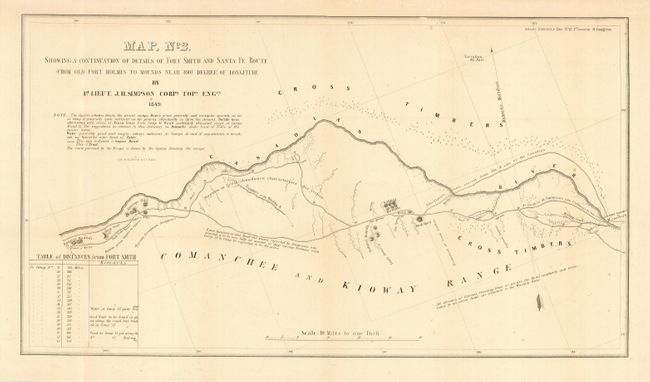
"Map No. 2. Showing a Continuation of Details of Fort Smith and Santa Fe Route from Old Fort Holmes to Mounds near 100 1/2 Degree of Longitude", Simpson, James H. (Lt. Col.)
Subject: Oklahoma
Period: 1849 (dated)
Publication: Senate Doc #12, 1st Session 31th Congress
Color: Black & White
Size:
19.8 x 11 inches
50.3 x 27.9 cm
Download High Resolution Image
(or just click on image to launch the Zoom viewer)
(or just click on image to launch the Zoom viewer)