Catalog Archive
Auction 115, Lot 272

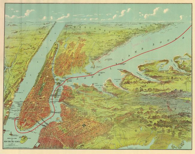
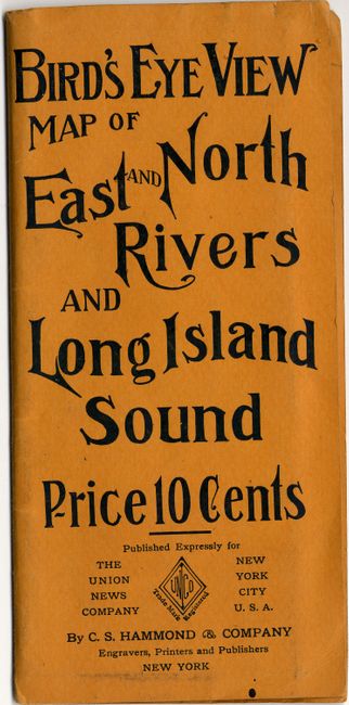
"Bird's Eye View Map of New York and Vicinity", Hammond Publishing Co.

Subject: New York

Period: 1912 (dated)

Publication:

Color: Printed Color

Size:
21.8 x 16.8 inches
55.4 x 42.7 cm
Download High Resolution Image
(or just click on image to launch the Zoom viewer)

Fabulous birds-eye view encompasses the entire area from the Jersey Shore to Huntington Bay. Shows Manhattan, Brooklyn, The Bronx, Mount Vernon, Greenwich and South Norwalk (CT), Flushing, Jamaica, Queens, Mineola, Cold Spring, and more. Shows Manhattan connected by the Brooklyn, Manhattan, Williamsburg, and Queensboro Bridges, plus numerous smaller bridges on the upper eastside across the Harlem River. This is a colorful pocket map that folds into printed wrappers (3.5 x 7.5") with title, "Bird's Eye View Map of East and North Rivers and Long Island Sound Price 10 Cents." Back of cover lists maps and atlases for sale by Hammond. Beautiful example of this tourist map.

References:

Condition: A

Map is mint less "June 19, 1919" written in light red pencil in blank area of Long Island Sound . Covers near mint also with just a little rubbing at bottom. Small red pencil notation on blank verso of map.

Estimate: $100 - $150

Sold for: $375

Closed on 6/21/2006

Archived