Catalog Archive
Auction 115, Lot 268

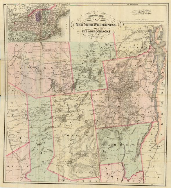
"Map of the New York Wilderness and the Adirondacks", Colton, G.W. & C.B.

Subject: New York

Period: 1873 (dated)

Publication:

Color: Hand Color

Size:
26.8 x 29.8 inches
68.1 x 75.7 cm
Download High Resolution Image
(or just click on image to launch the Zoom viewer)

Detailed and well drawn pocket map of upstate New York. Map extends from the eastern edge of Lewis and Oneida counties, east to Lake Champlain, south to show part of Saratoga county, and north to include Franklin and Lawrence counties. Good detail throughout including political boundaries, towns and villages, roads, railroads, lakes and watershed, and mountains in hachure. Large untitled inset of the northeast at upper left. Map folds into 12mo, gilt-stamped cloth covers. Map drawn by W.W. Ely, M.D. Paste-down on inside cover lists maps, atlases and guide books for sale by Colton.

References: cf Phillips, P.L. (Maps) p.514

Condition: A

Good color and impression. Map is fine less a couple small fold intersection splits.

Estimate: $220 - $275

Sold for: $275

Closed on 6/21/2006

Archived