Catalog Archive
Auction 115, Lot 257

"Montana Territory", General Land Office
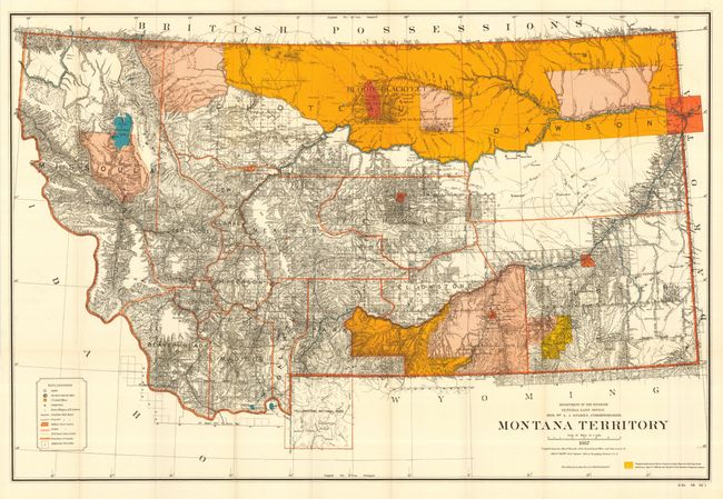
Subject: Montana

Period: 1887 (dated)

Publication: Senate Doc. 58, 52nd Cong., 1st Sess.

Color: Printed Color

Size:
39 x 26.2 inches
99.1 x 66.5 cm
Download High Resolution Image
(or just click on image to launch the Zoom viewer)

This is the uncommon large edition that shows in great detail the extent of public surveys in Montana. Hydrology and topography are well developed on this colorful map. The map shows Indian reservations (Blackfeet, Flathead etc.), military posts (Forts - Assiniboine, Keogh, Maginnis, Custer, Camp Baker, etc.) and the completed and proposed railroads; locates Custer Hill, Custer's Monument, and the Reno battlefield; shows Yellowstone National Park in its entirety with major features. Remarkable detail throughout on a scale of 1 inch to 15 miles. Extensive legend identifies land offices, Surveyor Generals Office, county seats, towns, villages and railroad stations, railroads (completed and proposed), military reservations, Indian reservations, railroad land grant limits, etc.

References:

Condition: A

Folding, as issued. Near fine with clear, bright impression and strong color. A couple small fold intersection splits and a archival tape repair in margin.

Estimate: $200 - $300

Sold for: $500

Closed on 6/21/2006

Archived