Catalog Archive
Auction 115, Lot 242

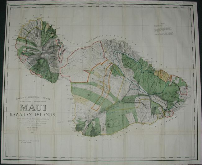
"Hawaii Government Survey - Maui Hawaiian Islands", Hawaii Territorial Surveys

Subject: Hawaii

Period: 1903 (dated)

Publication:

Color: Printed Color

Size:
53.5 x 43.5 inches
135.9 x 110.5 cm
Download High Resolution Image
(or just click on image to launch the Zoom viewer)

This is a large and handsome map that depicts Maui in great detail shortly after its annexation by the United States. Maui was the main island of the "county group" with a population approaching 40,000. Survey work during the previous decade had resulted in preparation of good maps, but there remained the problem of laying out the lands for settlement under existing land laws. This map delineates those lands for sale, awarded lands, and much more. Made under the direction of W.D. Alexander, Surveyor General. It was drawn by F.S. Dodge, 1895, with topography by Alexander, Dodge, C.J. Lyons, M.D. Monsarrat, S.E. Bishop, E.D. Baldwin, and W.R. Lawrence. This example has been updated to 1903 by John M. Donn.

References:

Condition: B

Beautiful impression and coloring. Issued folding, now pressed and backed with archival tissue. A hint of toning, else fine.

Estimate: $200 - $300

Sold for: $190

Closed on 6/21/2006

Archived