Catalog Archive
Auction 115, Lot 236

"Pensacola Harbor and Bar. Florida. Surveyed in 1822", Kearney, James (Major)
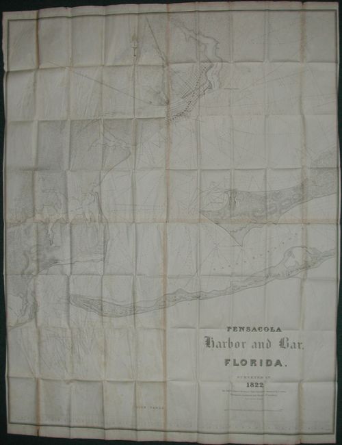
Subject: Florida

Period: 1822 (dated)

Publication: HR doc 8, 23rd Cong., 2nd Sess

Color: Black & White

Size:
46.3 x 57.6 inches
117.6 x 146.3 cm
Download High Resolution Image
(or just click on image to launch the Zoom viewer)

This large chart is a superb examination of Pensacola Harbor early in the state's history and recognizes its strategic importance. Formal possession of the Territory of Florida (from Spain) by the United States took place on 4 March, 1822, and the first session of its Legislative Council met on 22 July, 1822 in Pensacola. Britain had divided Florida into East and West colonies with Pensacola as the capital of West Florida. The largest battle ever fought in Florida was at Pensacola in May of 1781 with Spain defeating the English and thereafter taking over Florida. First issue of this large-scale folding map that covers from the Grand Lagoon and Foster's Island (present-day Perdido Key) to the Corporation of Pensacola. On a scale of 1" = 1/4 miles with great detail and hundreds of soundings. Shows the terminal of the proposed railroad from Columbus, GA. Four sheets joined and folding, as issued. A nice example of this very large map that should not be confused with a subsequent, and more common, small version.

References: Claussen & Friis #35; Koepp # I-16-2-6

Condition: B

Nice impression on four joined sheets, folding as issued. Close trimmed at sides, as issued. Some short marginal tears, scattered foxing, and toned along vertical join line. A few folds closed with archival tissue repair.

Estimate: $350 - $450

Sold for: $325

Closed on 6/21/2006

Archived