Catalog Archive
Auction 115, Lot 193

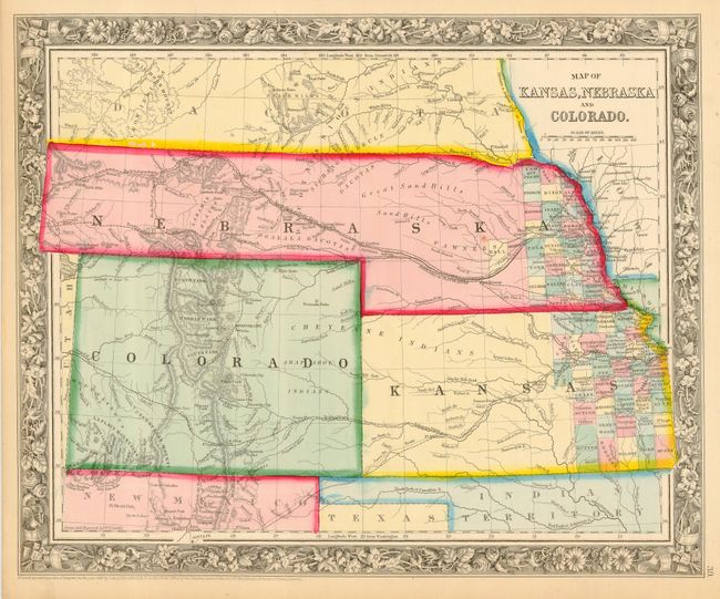
"Map of Kansas, Nebraska and Colorado", Mitchell, Samuel Augustus
Subject: United States - Central Midwest

Period: 1860 (dated)

Publication: General Atlas

Color: Hand Color

Size:
14 x 11.5 inches
35.6 x 29.2 cm
Download High Resolution Image
(or just click on image to launch the Zoom viewer)

Mitchell's first edition of this map features Nebraska with a long panhandle extending all the way to present-day Idaho. Names the PONY EXPRESS route. Locates numerous Indian tribes, forts and trading posts. Several roads or emigrant roads are shown but not named. County development in Kansas and Nebraska is limited to the eastern edge, with no counties at all in Colorado.

References:

Condition: A

One small spot in Nebraska, else fine example with dark impression, lovely original coloring and full margins. Professionally encapsulated in archival Mylar.

Estimate: $180 - $220

Sold for: $130

Closed on 6/21/2006

Archived