Catalog Archive
Auction 115, Lot 191

"Sketch of the Public Surveys in Wisconsin and Territory of Minnesota", U.S. State Surveys

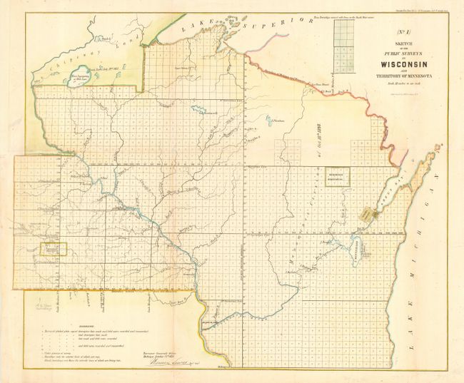
Subject: Wisconsin and Minnesota

Period: 1856 (dated)

Publication: Sen. Doc. #5, 3rd Session 34th Congress

Color: Hand Color

Size:
21.5 x 17.8 inches
54.6 x 45.2 cm
Download High Resolution Image
(or just click on image to launch the Zoom viewer)

Early government map of the region showing the progress of surveys extending well into the region west of the Mississippi. Several Indian reservation are shown including the first appearance of the Winnebago Reservation. In Minnesota Chipeway Land is noted above the Treaty Line, July 29th 1837. In Wisconsin the Menominee Cession of 1848 is shown. Several early settlements are located along the rivers including Prairie du Chien, St. Paul, Mankato and Brownsville. Also located are Fort Gaines and Fort Snelling.

References:

Condition: B

Attractive later color. Faint toning along one fold, which is reinforced on verso with tissue. Margin replaced at binding trim to better accommodate framing. Pencil notation at lower left above references.

Estimate: $100 - $130

Sold for: $50

Closed on 6/21/2006

Archived