Catalog Archive
Auction 115, Lot 175

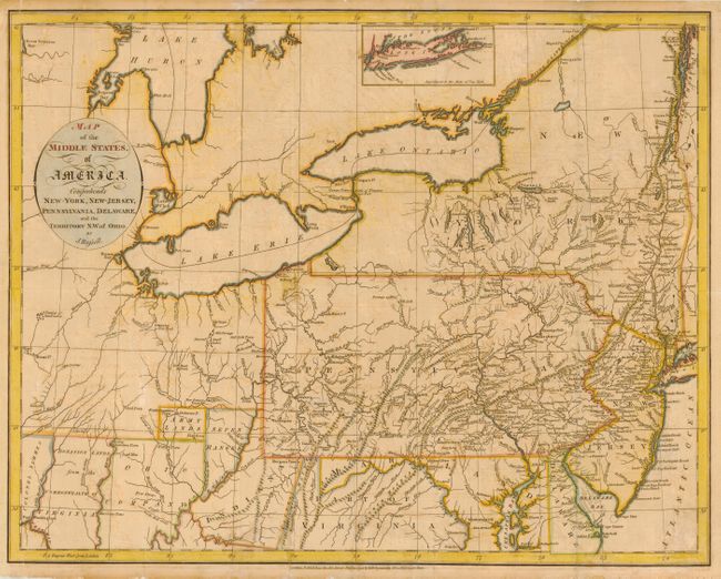
"Map of the Middle States of America. Comprehends New-York, New-Jersey, Pennsylvania, Delaware and the Territory N.W. of Ohio", Russell, John C.

Subject: United States - Mid-Atlantic

Period: 1794 (dated)

Publication: An American Atlas

Color: Hand Color

Size:
18.5 x 14.8 inches
47 x 37.6 cm
Download High Resolution Image
(or just click on image to launch the Zoom viewer)

Detailed map extending from New York through Delaware and west to Lake Huron, Great Traverse Bay, Ft. Miami and Ft. Washington. The region west of Virginia includes regions named Indiana, Seven Ranges, Army Lands, Ohio Company, Donation Lands from the Commonwealth of Virginia, and Colonel Simmes Grant. The map locates a host of early settlements including Hurricane Toms, Morgans Town, Lick Town, Kill Buck Town, Salt Lick Town, Wills Town, New Comers Town, and Beavers Town. It also locates Indian villages, forts, and mines.

References:

Condition: B

Lightly toned with offsetting and a few minor short repaired tears into border.

Estimate: $450 - $500

Sold for: $375

Closed on 6/21/2006

Archived