Catalog Archive
Auction 115, Lot 156

"A New Map of North America from the Latest Discoveries", Spilsbury, J.

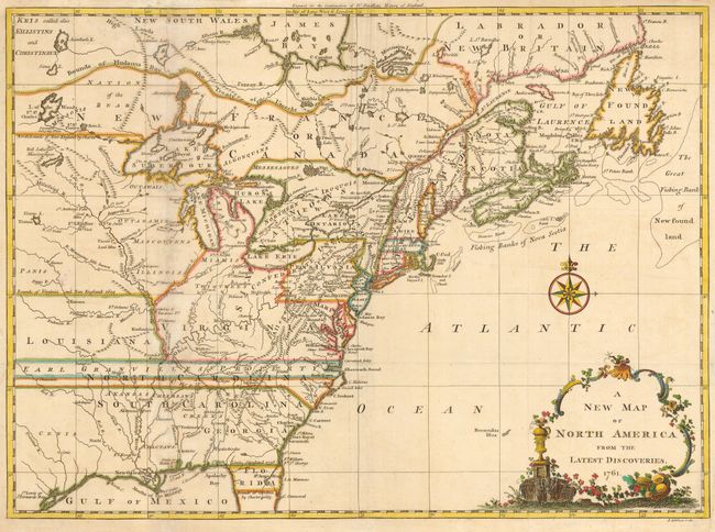
Subject: Colonial United States and Canada

Period: 1761 (dated)

Publication: Smollett's Continuation of the Complete History of England

Color: Hand Color

Size:
15 x 11 inches
38.1 x 27.9 cm
Download High Resolution Image
(or just click on image to launch the Zoom viewer)

Fine small map showing the colonial possessions in North America east of the Rocky Mountains. Shows early settlements, forts, Indian villages and tribal territory. The colonies are shown with their boundaries extending past the map's western border. Various treaty and charter boundaries are shown. Earl Granville's Property stretches from the Atlantic west to beyond the Mississippi River. In Florida a line from Fort St. George to St. Mark delineates the Limits Stipulated in 1738, and below - nearly to Cape Canaveral are the Bounds of Carolina by Charter of 1665. The fishing banks off Canada are prominently noted. Delicate title cartouche and compass rose. First state.

References: McCorkle #761-3; Sellers & Van Ee #89.

Condition: B

Fine later color. Some toning along folds, which are reinforced with tissue on verso.

Estimate: $375 - $450

Sold for: $550

Closed on 6/21/2006

Archived