Catalog Archive
Auction 115, Lot 152

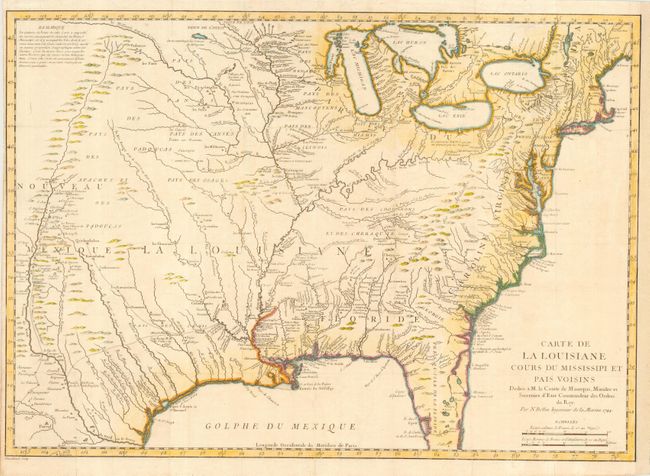
"Carte de la Louisiane Cours du Mississipi et Pais Voisins…", Bellin, Jacques Nicolas

Subject: United States - Eastern

Period: 1744 (dated)

Publication: Histoire et Description…de La Nouvelle France…

Color: Hand Color

Size:
22.5 x 16 inches
57.2 x 40.6 cm
Download High Resolution Image
(or just click on image to launch the Zoom viewer)

This interesting map appeared in the journal of Pierre Francois Xavier Charlevoix, a French Jesuit historian and traveler who traveled throughout the French possessions in North America. The map covers from the Great Lakes through all but the tip of Florida, and from New Mexico and the Rocky Mountains through the eastern seaboard. The information in the west includes the road from Mexico City to Santa Fe and the routes of St. Denis and De Soto though Texas. The Riviere du Nord (Rio Grande) has its headwaters in the upper left corner, only a few miles from the Missouri River. There is great detail of Indian villages, trading agencies, forts, mines, villages, and colonial settlements. Bellin based the map on Guillaume Delisle's landmark map of 1718. While covering the same area, Bellin's map incorporates much new information from Charlevoix and other French explorers, particularly in the lakes and rivers and additional place names. Sometimes overlooked because of its similarity to Delisle's map, this map occupies an important step in the cartographic history of North America.

References: McCorkle #744-1.

Condition: B

Issued folding, now pressed. Narrow left margin, as issued. Remargined at right with partial facsimile of neatline with a repaired 4" binding tear.

Estimate: $1,000 - $1,300

Sold for: $550

Closed on 6/21/2006

Archived