Catalog Archive
Auction 114, Lot 631

"Moluccae Insulae Celeberrimae", Hondius/Blaeu

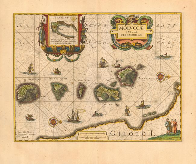
Subject: East Indies - Indonesia

Period: 1635 (circa)

Publication:

Color: Hand Color

Size:
19 x 14.5 inches
48.3 x 36.8 cm
Download High Resolution Image
(or just click on image to launch the Zoom viewer)

Superb map of the Spice Islands based on the islands described by Jan Huyghen van Linschoten. This map was the first large-scale map of the region and depicts the islands that provided first the Portuguese, and then the Dutch, with a monopoly on the lucrative spice trade. Each of the islands is shown with groves of the prized clove and nutmeg trees and the location of their protective fortresses. Originated by Jodocus Hondius, the plate was purchased by Blaeu in 1629. Very decorative title cartouche and a cartouche enclosing an inset map of Bachian Island. Other decoration includes 2 compass roses, various types of sailing ships, and sea monsters.

References:

Condition: B

Fine impression and color. Generally very good with a couple of unobtrusive spots due to small paper flaws. Printed on fine quality paper with a small hole in blank margin just outside bottom border.

Estimate: $700 - $800

Sold for: $550

Closed on 3/1/2006

Archived