Catalog Archive
Auction 114, Lot 619

"Die Insel Madagascar…", Bry, Theodore de
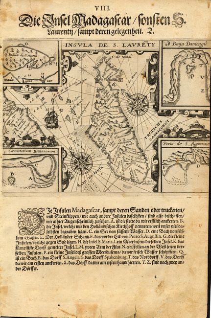
Subject: Madagascar

Period: 1599 (circa)

Publication: India Orientalis Part II

Color: Black & White

Size:
7.6 x 5.6 inches
19.3 x 14.2 cm
Download High Resolution Image
(or just click on image to launch the Zoom viewer)

This uncommon map of Madagascar illustrates the earliest voyage of the Dutch to the East Indies in 1595. The map is oriented by two large compass roses with northeast to the top. The corners of the map are filled with four detailed insets of the important bays showing the navigational hazards and Insula de S. Maria. Place names are from the earliest Portuguese explorers. Dutch text below.

References:

Condition: B

Some stains and soiling. Some minor tears in margins with old or archival tape repairs.

Estimate: $275 - $325

Unsold

Closed on 3/1/2006

Archived