Catalog Archive
Auction 114, Lot 569

"Map of Palestine and all Bible Lands…", Demarest, B.S.
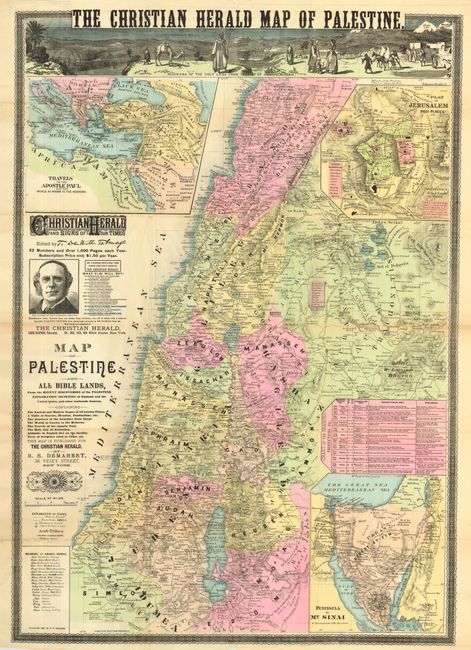
Subject: Holy Land

Period: 1887 (dated)

Publication:

Color: Hand Color

Size:
25 x 35.8 inches
63.5 x 90.9 cm
Download High Resolution Image
(or just click on image to launch the Zoom viewer)

Large and scarce map of the Holy Land that was published by The Christian Herald. The map covers the region in great detail showing villages, roads, and mountains in hachure. Many place names have the related Bible chapter and verse listed adjacent. With a large inset "Travels of the Apostle Paul" at upper left and "Peninsula of Mt. Sinai" at lower right. Across the top of the map is an engraved view titled "Panorama of the Holy Land from the Top of Mount Riscah" and title above this "The Christian Herald Map of the Holy Land." A table gives the English translation for about 20 Arabic words used on the map. Above the title is an advertisement for the Christian Herald featuring a portrait of Thomas De Witt Talmage, editor of the paper. Talmage had earlier edited Frank Leslie’s Sunday Magazine. Surrounded by a very fine banknote style border. A very uncommon issue.

References:

Condition: B

Fine, full hand coloring on thin paper with very nice impression. Issued folding, now rolled. Several fold intersection splits, one split along fold line with some local brittleness.

Estimate: $200 - $250

Sold for: $150

Closed on 3/1/2006

Archived