Catalog Archive
Auction 114, Lot 423

"Nieuwe Pascaart van de Zeekusten van Bretangne, Beginnende van 't Incoomen van de Rivier de Loire", Keulen, Johannes van
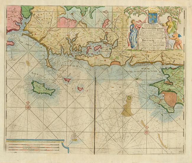
Subject: France

Period: 1681 (circa)

Publication:

Color: Hand Color

Size:
23.2 x 19 inches
58.9 x 48.3 cm
Download High Resolution Image
(or just click on image to launch the Zoom viewer)

Handsome sea chart covering the Brittany coast from Lorient to Pointe de Croisic and including Belle-Ile. The map is filled with detail including anchorages and soundings with an inset of Port-Louis. The map is embellished with rhumb lines, compass roses, a sailing ship and a large title cartouche featuring shepherds, sheep, a cherub and a coat of arms.

References:

Condition: B

Excess printer's ink along centerfold with impression somewhat uneven. Good original margins. Slight toning along centerfold.

Estimate: $350 - $400

Sold for: $550

Closed on 3/1/2006

Archived