Catalog Archive
Auction 114, Lot 357
"A Correct Map of Europe Divided into its Empires Kingdoms &c Drawn from the most Approved Maps and Charts regulated by Astron. Observat. [4 sheets]", Kitchin, Thomas
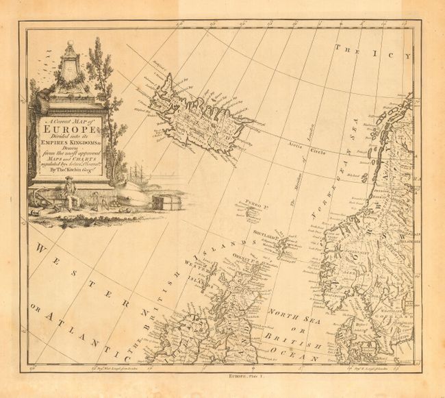
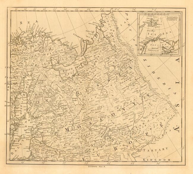
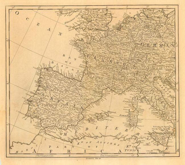
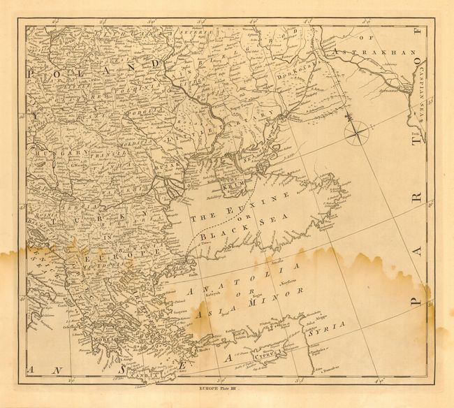
1 of 4
Subject: Europe
Period: 1780 (circa)
Publication:
Color: Black & White
Size:
15.7 x 13.7 inches
39.9 x 34.8 cm
Download High Resolution Image
(or just click on image to launch the Zoom viewer)
(or just click on image to launch the Zoom viewer)