Catalog Archive
Auction 114, Lot 283

"Geological Map of Vermont Traced out and compiled by the Members of the Geological Survey",
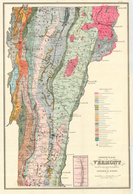
Subject: Vermont

Period: 1861 (dated)

Publication: Report on the Economical Geology...of Vermont

Color: Hand Color

Size:
17 x 25.3 inches
43.2 x 64.3 cm
Download High Resolution Image
(or just click on image to launch the Zoom viewer)

Very detailed and colorful map from A.G. Hager's report. The map was compiled by members of the Vermont Geological Society, which continue operating today. The map has an extensive legend that locates 27 different geological formations though color and pattern. Also locates copper and iron pyrites, ores of iron older than the Tertiary, quarries and mines, and arrows that indicate the strike and dip of the underlying strata. Interestingly, the society printed a different legend and pasted it down over the original. Inset "West Rutland Marble Quarries" locates and names numerous quarries. A most uncommon issue.

References: Cobb No. 330.

Condition: A

Folding, as issued. Lovely original color. Closed 2" binding trim tear in blank area at right, right margin a little rough, still very good.

Estimate: $180 - $220

Sold for: $120

Closed on 3/1/2006

Archived