Catalog Archive
Auction 114, Lot 275

"A Map of the Tennassee State formerly Part of North Carolina taken Chiefly from Surveys by Genl. D. Smith & others", Carey, Mathew
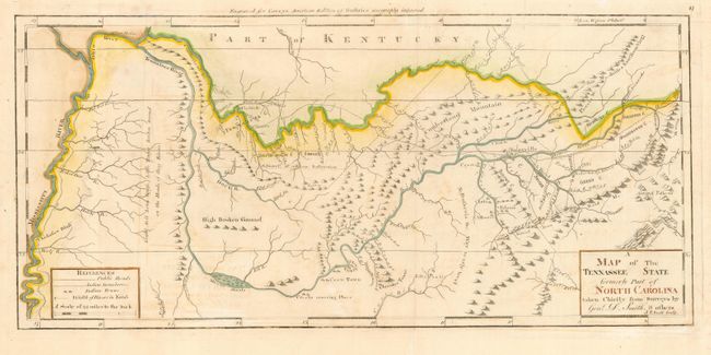
Subject: Tennessee

Period: 1800 (circa)

Publication: Carey's General Atlas

Color: Hand Color

Size:
20.3 x 9.5 inches
51.6 x 24.1 cm
Download High Resolution Image
(or just click on image to launch the Zoom viewer)

This is a superb early map of Tennessee based on the first surveys of the region by General Daniel Smith, one of the Virginia members of the 1779-80 Virginia-North Carolina border commission. The map extends from the Mississippi River to the Appalachians and includes notations on the S. Boundary of the Military Reservation, the Kentucky Road, early counties and settlements, Indian boundaries and villages and much other fascinating information. This is the third state, updated with the names of eight counties. Engraved by Joseph T. Scott.

Mathew Carey was a seminal figure in early American publishing; establishing the first publishing firm to specialize in cartography and issuing the first atlas devoted exclusively to American maps. He set up an elaborate cottage system of craftsmen for compiling, engraving, printing, and coloring maps. This practice was emulated by later American cartographic publishers such as John Melish and Henry S. Tanner. The American Atlas concept was also adopted by other publishers in both the United States and Europe.

References: Wheat & Brun #653.

Condition: B

Wide original margins and a few minor creases. Bit of light foxing and offsetting.

Estimate: $1,500 - $1,800

Sold for: $850

Closed on 3/1/2006

Archived