Catalog Archive
Auction 114, Lot 203

"North Western America showing the Territory ceded by Russia to the United States", Mitchell, Samuel Augustus
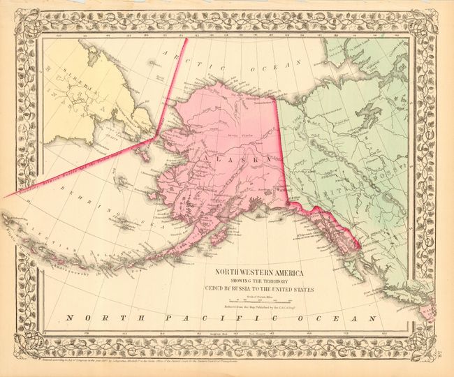
Subject: Alaska

Period: 1867 (dated)

Publication:

Color: Hand Color

Size:
14 x 11.6 inches
35.6 x 29.5 cm
Download High Resolution Image
(or just click on image to launch the Zoom viewer)

This early map of Alaska is dated only three years after the territory was purchased from Russia, and infamously named Seward's Folly. It shows Alaska with no organized areas and the interior virtually blank, save for the occasional river and Fort Yukon. Just a few villages are named and there is no sign of Mt. McKinley. Sitka is called New Archangel. One of the first atlas maps of Alaska Territory. Enclosed in a decorative grapevine border.

References:

Condition: A

Estimate: $100 - $140

Sold for: $80

Closed on 3/1/2006

Archived