Catalog Archive
Auction 114, Lot 132

"Map of the United States and Canada", Smith, Roswell C.

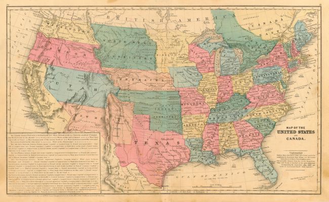
Subject: United States

Period: 1853 (dated)

Publication: Smith's Quarto Geography

Color: Hand Color

Size:
17.6 x 10.5 inches
44.7 x 26.7 cm
Download High Resolution Image
(or just click on image to launch the Zoom viewer)

A great school atlas map with full original hand coloring to delineate the early territorial borders in the west. The territories of Washington and Oregon extend to the Continental Divide, Utah is a huge area that extends to California and to Indian Territory and Nebraska. New Mexico Territory occupies all of today's Arizona and part of Colorado and features a pre-Gadsden Purchase border with Mexico as the treaty was not finalized until late 1853. A huge North West Territory extends between the Continental Divide and Minnesota and is bounded by Canada and Nebraska. Nebraska territory is oversized and also extends to the Continental Divide. Minnesota Territory extends to the Missouri River. A large Gold Region is shown in north central California. Each state/territory is labeled with their population. Large panel at lower left is a teacher's aid with questions. Covers only the region of Canada along the U.S. boundary. Published for Smith by Daniel Burgess.

References:

Condition: B

Original coloring and good impression. Some light surface soiling or toning, mostly in lower right center, two marginal tears near centerfold at bottom that enter border, and a series of tiny holes at centerfold visible when held to a strong light.

Estimate: $90 - $110

Sold for: $180

Closed on 3/1/2006

Archived