Catalog Archive
Auction 114, Lot 127

"America Russia America Nord Ouest", Marmocchi, Francesco

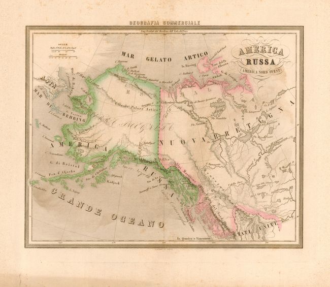
Subject: Canada and Alaska

Period: 1858 (dated)

Publication: Geografia Commerciale

Color: Hand Color

Size:
13.3 x 10.5 inches
33.8 x 26.7 cm
Download High Resolution Image
(or just click on image to launch the Zoom viewer)

Very scarce issue centered on today's Yukon Territory, the map extends west through Alaska to the Bering Strait, and east to show the headwaters of the Mississippi, Fort Reliance, etc. Most of the interior is devoid of detail, particularly so in Alaska where in the supposed path of the Yukon River is shown with a dotted line. The map extends south to the United States, here Stati Uniti, to show the headwaters of the Missouri River. Interestingly the map shows the United States claims into present-day British Columbia. In the lower margin is the embossed stamp of Paolo Rivara. The map was published by Paolo Rivara and engraved by C. Magrini. This scarce map was separately issued, most likely from a subscription as these maps were mailed loose allowing the subscriber the pleasure of choosing the content and style of binding.

References:

Condition: B

On a sheet of thick paper with very wide margins. Good impression and original hand coloring in outline. A little scattered foxing, more in margins.

Estimate: $150 - $250

Sold for: $100

Closed on 3/1/2006

Archived