Catalog Archive
Auction 114, Lot 121

"A Chart of the Sea Coast of New Foundland New Scotland New England New York New Jersey with Virginia and Maryland", Thornton, John

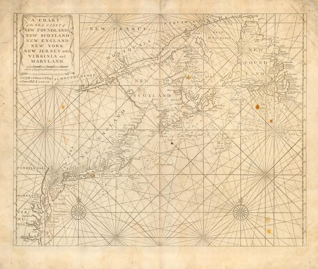
Subject: Colonial United States and Canada

Period: 1770 (circa)

Publication: English Pilot

Color: Black & White

Size:
23 x 17.8 inches
58.4 x 45.2 cm
Download High Resolution Image
(or just click on image to launch the Zoom viewer)

Scarce colonial chart that details major harbors, bays, banks, and towns along the Atlantic coast from the Chesapeake Bay to Labrador and up the St. Lawrence River as far as Quebec. Details include shoals, rocks and soundings. Second edition of this chart that is virtually identical to the first except for the curtain around the title cartouche and New Found Land changed to New Foundland. Published by Mount & Page.

References: McCorkle #698.6; Sellers and Van Ee #199.

Condition: B

Wide margins. Soiled with some spots of candle wax and a couple of worm holes. Backed with Japanese tissue repairing marginal fold separations.

Estimate: $1,500 - $1,600

Sold for: $975

Closed on 3/1/2006

Archived