Catalog Archive
Auction 114, Lot 102

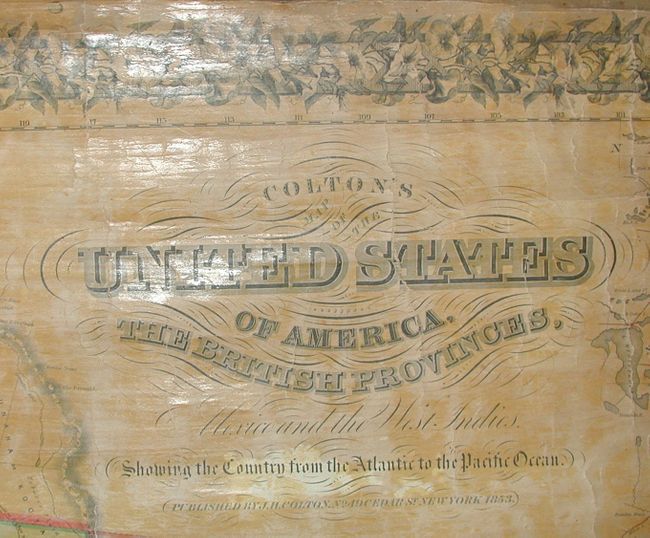
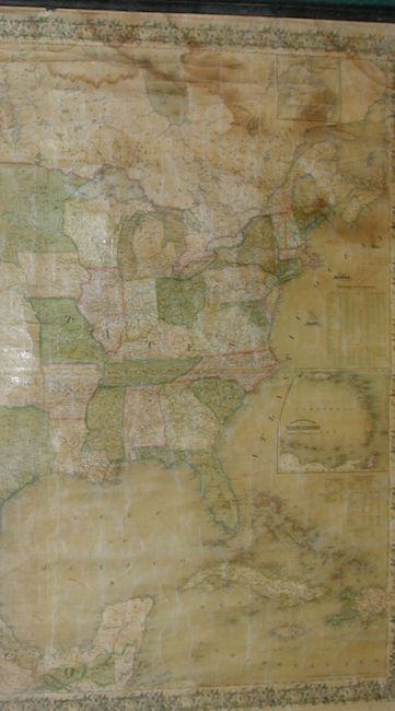
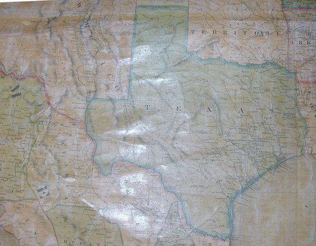
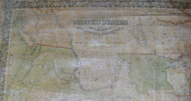
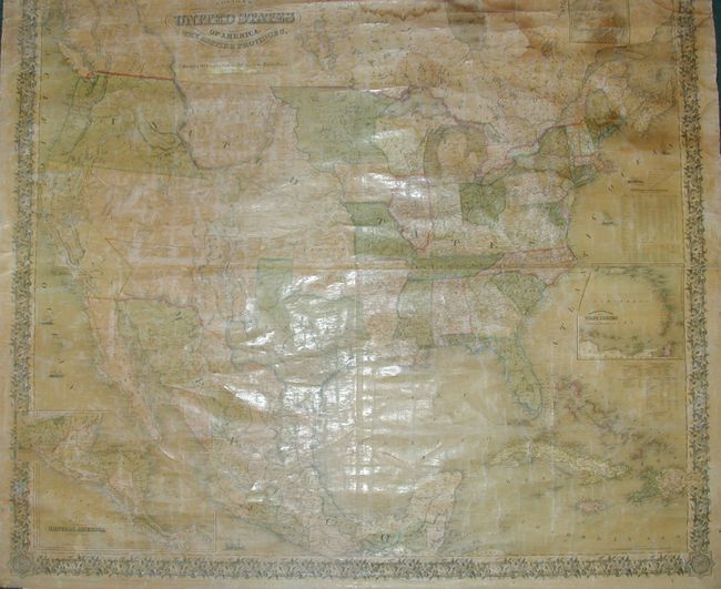
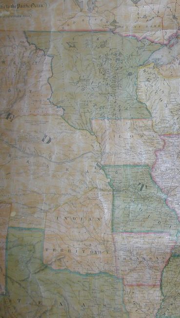
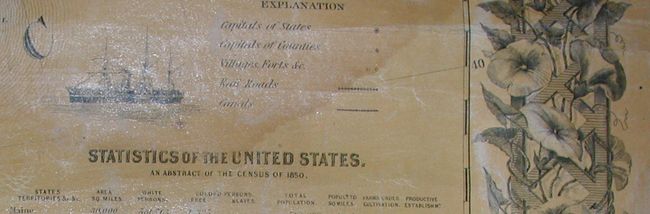
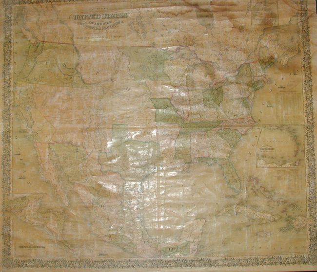
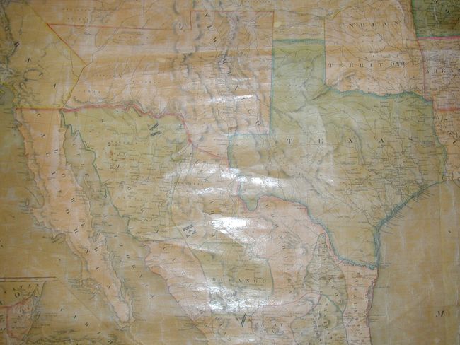
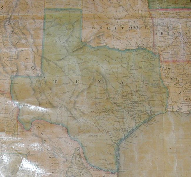
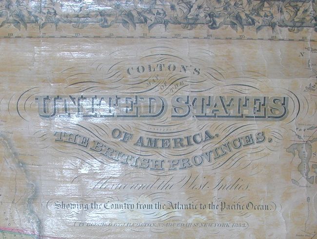
"Colton's Map of the United States of America, The British Provinces, Mexico and the West Indies, Showing the Country from the Atlantic to the Pacific Ocean", Colton, Joseph Hutchins

Subject: North America

Period: 1853 (dated)

Publication:

Color: Hand Color

Size:
57 x 50.5 inches
144.8 x 128.3 cm
Download High Resolution Image
(or just click on image to launch the Zoom viewer)

Wheat states that this new edition "creditably incorporates some of the latest information, including the new geography given to the world of cartography by the Stansbury maps of 1852." Terrific early western borders are exhibited, including Washington and Oregon Territories extending to a large Northwest Territory at the Continental Divide. The Northwest Territory continues to Minnesota Territory at the Missouri River. The Utah Territory reaches from California to Nebraska Territory which extends north to south between Northwest and Indian territories. The large New Mexico Territory includes all of today's Arizona, north into Nebraska Territory and features a pre-Gadsden Purchase southern boundary with Mexico. Three insets show Newfoundland, part of the West Indies, and a large map of Central America. A table gives the "Statistics of the United States." This beautiful chart is embellished with decorative borders and numerous small engraved vignettes throughout the map showing Indians and wildlife. Both rollers are present and attached. A very nice example.

References: Wheat (TMW) #776.

Condition: B

Map is very sound with no serious flaws or missing image. Varnish with some darkening. Couple of marginal tears. Water stain extends across top and a bit lower in the area of the Maritime Provinces, else very good.

Estimate: $1,200 - $1,800

Sold for: $1,300

Closed on 3/1/2006

Archived