Catalog Archive
Auction 113, Lot 97

"Carte du Mexique et de la Floride des Terres Angloises et des Isles Antilles…", Delisle/Covens & Mortier

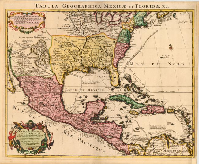
Subject: Colonial America

Period: 1722 (dated)

Publication: Atlas Nouveau

Color: Hand Color

Size:
23.5 x 18.5 inches
59.7 x 47 cm
Download High Resolution Image
(or just click on image to launch the Zoom viewer)

This is Covens & Mortier's issue of Delisle's important map that is credited with accurately showing the course of the Mississippi River and its mouth for the first time. The map influenced later delineations of the Mississippi River by Seutter, Homann, Lotter and others for many years. A most attractive map that includes much of the present day United States, Mexico, Central America, and the Caribbean. The map locates the British Colonies, Florida extends past the Mississippi River, and the Southwest is labeled Nouveau Mexique. This issue has the route of the Spanish galleons added, and the title in Latin along the top margin. A very nice example of this important map

References: Tooley [Amer] #51; Schwartz & Ehrenberg Plt. 82; cf Cummings (SE) #137; Martin & Martin plt.17.

Condition: A

Beautiful and early impression that is remarkably dark and still exhibiting layout lines in text. Fine original hand coloring. Darkening in margins likely from framing. A trace of soiling on map, still very good.

Estimate: $1,800 - $2,200

Sold for: $1,500

Closed on 12/7/2005

Archived