Catalog Archive
Auction 113, Lot 89

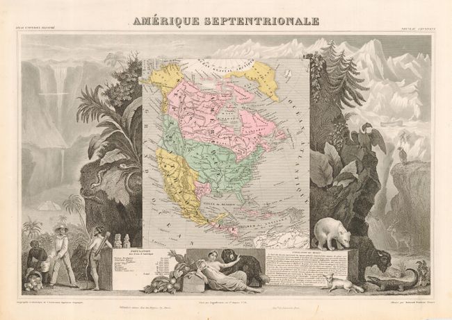
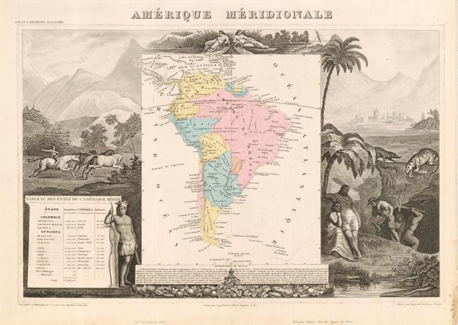
"[Lot of 2] Amerique Septentrionale [and] Amerique Meridionale", Levasseur, Victor

Subject: Western Hemisphere

Period: 1850 (circa)

Publication: Atlas National Illustre

Color: Hand Color

Size:
17 x 11 inches
43.2 x 27.9 cm
Download High Resolution Image
(or just click on image to launch the Zoom viewer)

Victor Levasseur's "Atlas National Illustre" and "Atlas Universel Illustre" are among the last decorative atlases published. The maps are all lavishly illustrated with scenes of the countryside, products and activities indigenous to the region.

First is the very popular and decorative map of North America that features an Independent Texas. The United States extends into present day Canada (the 54-40 or Fight dispute with England), Russia is in control of Alaska, and Mexico's northern border is shown according to the Treaty of 1819. The map is surrounded by beautifully engraved, uncolored, scenes of North and Central America including local animals, a ship stranded in the polar sea, and a Mayan Temple. Second is a matching and equally decorative map of South America. It is hand colored to show political divisions with the map surrounded by uncolored steel engraved scenes including horses, Indians, mining and indigenous animals.

References: NA - Manasek #110.

Condition: A

Both with good impressions and fine original full hand coloring in maps. A little glue residue in lower right margin of South America. Paper size is slightly different with margins on South America slightly trimmed but are still substantial.

Estimate: $350 - $400

Sold for: $190

Closed on 12/7/2005

Archived