Catalog Archive
Auction 113, Lot 782

"Parte del Africa", Ramusio, Giovanni Battista

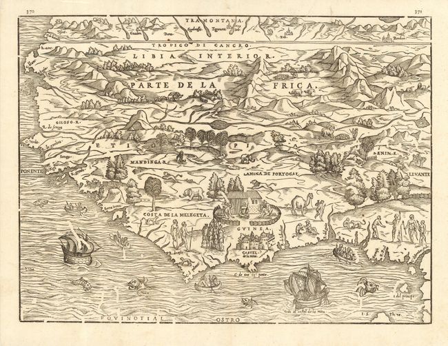
Subject: Western Africa

Period: 1565 (circa)

Publication: Delle Navigatione e Viaggi

Color: Black & White

Size:
14.3 x 10.6 inches
36.3 x 26.9 cm
Download High Resolution Image
(or just click on image to launch the Zoom viewer)

Superb woodblock map of Western Africa compiled by the Venetian cartographer Gastaldi and published in this important 16th century description of voyages of discovery. The map covers from the Tropic of Cancer to the Equator and is filled with mountains and a variety of different trees, animals and natives. The sea is alive with sea monsters, native canoes and two European ships. Along the coast of Guinea is a scene of natives paying homage to a chieftain and below that is the Portuguese fort, Castel de la Mina (modern Elmina), which was founded in 1482 and became the major export center for African gold. The Senegal and Gambia Rivers and the Rio Grande are linked with the Niger River.

References: Norwich #314;

Condition: A

Fine impression with some voids that were caused by worming of the printing block.

Estimate: $800 - $950

Sold for: $500

Closed on 12/7/2005

Archived