Catalog Archive
Auction 113, Lot 779

"Carte Particuliere de l'Egypte, de la Nubie et de l'Abyssinie", Chatelain, Henry Abraham
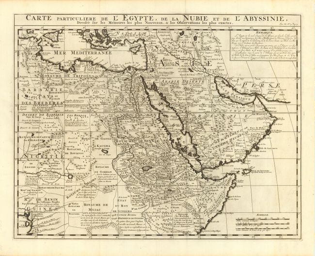
Subject: Northeast Africa and Arabia

Period: 1719 (circa)

Publication: Atlas Historique…

Color: Black & White

Size:
20 x 15.5 inches
50.8 x 39.4 cm
Download High Resolution Image
(or just click on image to launch the Zoom viewer)

This handsome map is based on the work of the important French cartographer Guillaume Delisle. It is a very detailed and fascinating view of northeastern Africa, the Red Sea and the Arabian Peninsula showing the political divisions and kingdoms. The Nile originates in the mountains near the L. de Dambee. The map extends to show a small portion of the west coast of Africa in the Gulf of Guinea. There are three distance scales and an extensive note in block at upper right.

References:

Condition: A

Dark impression on a full sheet of hand laid paper with wide margins and a large, complex watermark.

Estimate: $400 - $450

Sold for: $300

Closed on 12/7/2005

Archived