Catalog Archive
Auction 113, Lot 763

"A New Map of Libya or old Africk Shewing its general Divisions, most remarkable Countries or People, Cities, Townes, Rivers, Mountains, &c.", Wells, Edward
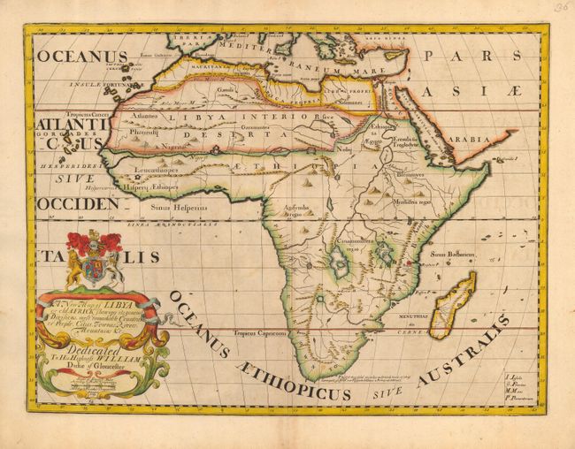
Subject: Africa

Period: 1700 (circa)

Publication: A New Sett of Maps Both of Antient and Present Geography

Color: Hand Color

Size:
19 x 14.2 inches
48.3 x 36.1 cm
Download High Resolution Image
(or just click on image to launch the Zoom viewer)

Wells' atlas contained two maps of each region - one with its then current form and another with ancient and classical names. This is his 'ancient' map of Africa, and although the whole continent is shown, only the geography of Ptolemy is presented. Therefore, the map is largely blank, particularly in the south, which is noted as Unknown to the Ancients. The only city south of the Equator is Rapta metropolis Barbariae and there is a notation at the tip that Vacquez de Gama was the first to sail around Africa in 1497. The large title cartouche is surmounted by the coat of arms of the Duke of Gloucester, who was Wells' student at Oxford.

References: Norwich #60.

Condition: B

Lightly toning with faint offsetting, else very good with a dark impression and attractive old color.

Estimate: $400 - $450

Sold for: $300

Closed on 12/7/2005

Archived