Catalog Archive
Auction 113, Lot 507

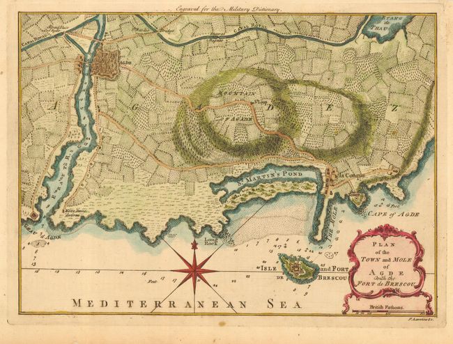
"Plan of the Town and Mole of Agde with the Fort de Brescou", Hinton, John

Subject: France

Period: 1760 (circa)

Publication:

Color: Hand Color

Size:
10.8 x 7.8 inches
27.4 x 19.8 cm
Download High Resolution Image
(or just click on image to launch the Zoom viewer)

Well engraved chart of Agde near the towns of Marseillan and Bessan, and the adjacent coastline of southern France along the Gulf of Lion. Shows the Mountain of Agde and the Basin de Thau, here called St. Martin's Pond. Also locates la Conque, the Tower, Sluce of Bagnas, the Canal Royal, St. Basile's, and the Notre Dame div Grau. Offshore is the Isle and Fort de Brescou which appears to be the location of today's Sete. Also details the individual fields, trails and wagon roads. Above the map is "Engraved for the Military Dictionary." Engraved by F.A. Aveline.

References:

Condition: A

Fine impression and coloring on hand laid paper with original margins, a little close at top. Attractive, even ivory age toning.

Estimate: $120 - $160

Unsold

Closed on 12/7/2005

Archived