Catalog Archive
Auction 113, Lot 322

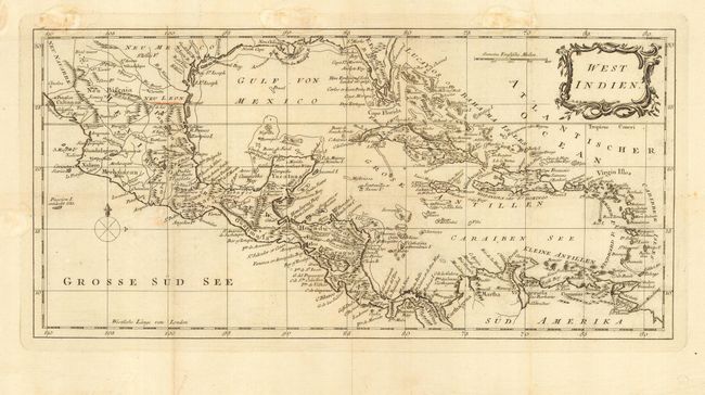
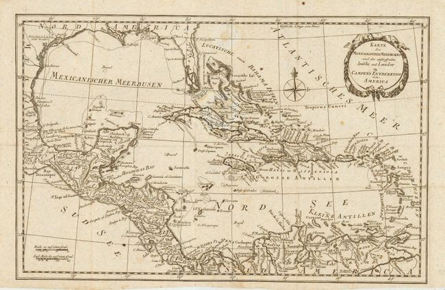
"[Lot of 2] West Indien [and] Karte des Mexicanischen Meerbusens und der anstossenden Inseln und Laender zu Campens Entdekkung von America",

Subject: Gulf of Mexico and Caribbean

Period: 1790 (circa)

Publication:

Color: Black & White

Size:
See Description
Download High Resolution Image
(or just click on image to launch the Zoom viewer)

Pair of interesting German maps of the Gulf of Mexico and the Caribbean. Both are filled with good detail of topography and show several small islands and shoals, considering their small size. Both also depict Florida with islands making up the southern part of the peninsula; although the shape varies between the maps. First (14.5 x 7") is anonymous; second (12.5 x 8.2") is by Friedrich Campe of Nuremberg.

References:

Condition: B

Issued folding, now pressed. Some light foxing or damps stains.

Estimate: $140 - $180

Sold for: $210

Closed on 12/7/2005

Archived