Catalog Archive
Auction 113, Lot 296

"[Western United States and Mexico]", Andriveau-Goujon, E.

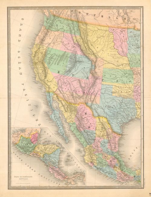
Subject: Western United States and Mexico

Period: 1861 (circa)

Publication: Atlas Universel

Color: Hand Color

Size:
18 x 24.5 inches
45.7 x 62.2 cm
Download High Resolution Image
(or just click on image to launch the Zoom viewer)

A large and very detailed map of the states and territories of the West, down through Mexico, with Central America included in a large inset titled "Etats de l'Amerique Centrale." This map was produced during the Civil War and exhibits the interesting and shifting territorial boundaries during this period. Arizona shows up in the southern third of New Mexico Territory. This is thought to represent the Confederate Territory of Arizona that existed for nearly a year from August 1861 until July of 1862. The Confederate General Baylor appointed himself the territorial governor and claimed all of New Mexico Territory south of the 34th Parallel, naming it the Confederate Territory of Arizona. The Utah/Nevada border is at 116° and Utah extends to Colona, a proposed name for the territory of Colorado. Oregon has become a state leaving the area of southern Idaho, normally shown attached to Washington Territory, ill-defined and simply labeled Shoshone. A beautiful and colorful map that details the Emigrant Roads to Oregon and California, Indian Tribes, town, forts, mountains and watershed.

References:

Condition: A

Beautiful, full original color and crisp impression. Printed on thick paper with a few spots in blank ocean, short fold split, closed on verso, else fine.

Estimate: $250 - $300

Sold for: $325

Closed on 12/7/2005

Archived