Catalog Archive
Auction 113, Lot 294

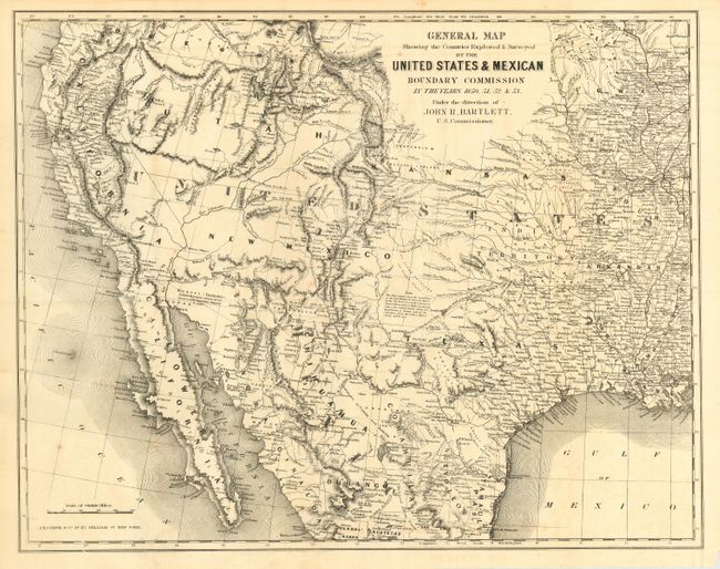
"General Map Showing the Countries Explored & Surveyed by the United States & Mexican Boundary Commission in the Years 1850, 51, 52 & 53", Bartlett, John Russell
Subject: Western United States & Mexico

Period: 1854 (published)

Publication: Personal Narrative of Explorations…

Color: Black & White

Size:
19 x 15 inches
48.3 x 38.1 cm
Download High Resolution Image
(or just click on image to launch the Zoom viewer)

Informative map that is important for its early reporting of the Gadsden Purchase border. The map covers the entire west from the Mississippi River with particular emphasis on the land recently obtained from Mexico. Filled with place names, numerous Indian villages, geographical notes and more. A remarkable general map for this important boundary treaty. Published in Bartlett's "Personal Narrative of Explorations and Incidents in Texas, New Mexico, California, Sonora, and Chihuahua, Connected with the United States and Mexican Boundary Commission, During the Years 1850, '51, '52, and '53."

References: Wheat (TMW) #798; Howes B-197; Wagner-Camp 234:1; Sabin 87268.

Condition: A

Folding, as issued. Good impression with just a hint of toning along a fold.

Estimate: $550 - $650

Sold for: $375

Closed on 12/7/2005

Archived