Catalog Archive
Auction 113, Lot 260

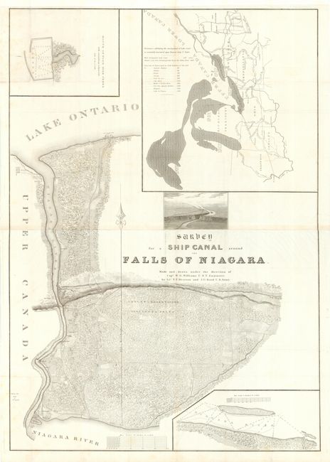
"Survey for a Ship Canal around the Falls of Niagara", U.S. Army

Subject: New York

Period: 1836 (published)

Publication: HR Doc 214, 24th Congress, 1st Session.

Color: Black & White

Size:
29 x 41.5 inches
73.7 x 105.4 cm
Download High Resolution Image
(or just click on image to launch the Zoom viewer)

Large survey chart prepared by Lts. T. F. Drayton and J. C. Reed. The chart shows a proposal for building a canal around Niagara Falls to allow shipping from Lake Erie to Lake Ontario. The topography is precisely presented with insets of a harbor at Four Mile Creek, a map of the Great Lakes taken from Tanner's map of the U.S., a chart of the Niagara River near the falls, and a bird's-eye view of the region showing the elevation change the canal would traverse. Though the canal was never built, this map is a great example of American engineering design and mapmaking in the early part of the nineteenth century. Printed on 2 joined sheets, as issued.

References: Claussen & Friis #129.

Condition: A

Folding as issued with a bit of very faint foxing, overall very good.

Estimate: $275 - $350

Sold for: $200

Closed on 12/7/2005

Archived