Catalog Archive
Auction 113, Lot 250

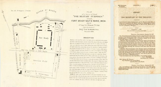
"Plat of a Survey of Land For Military Purposes around Fort Brady Saut St. Marie, Mich.", U.S. Army

Subject: Michigan

Period: 1846 (dated)

Publication:

Color: Black & White

Size:
12.5 x 8.3 inches
31.8 x 21.1 cm
Download High Resolution Image
(or just click on image to launch the Zoom viewer)

Plan of Fort Brady and environs, together with the introductory page of the "Report of the Secretary of the Treasury" that accompanied the map. Fort Brady was constructed by Colonel Hugh Brady and his men in 1822. It was originally built on the grounds of an old French fort (Fort Repentigny), and was established to bring an American military presence and to regulate the fur trade in the region. This survey was conducted to establish the boundaries of the military reservation in a dispute between the military, Indian and private land claims.

References:

Condition: A

Folding as issued with a couple of tiny spots, still very good.

Estimate: $90 - $120

Sold for: $65

Closed on 12/7/2005

Archived