Catalog Archive
Auction 113, Lot 239

"Carte du Canal de Bahama", Bellin, Jacques Nicolas

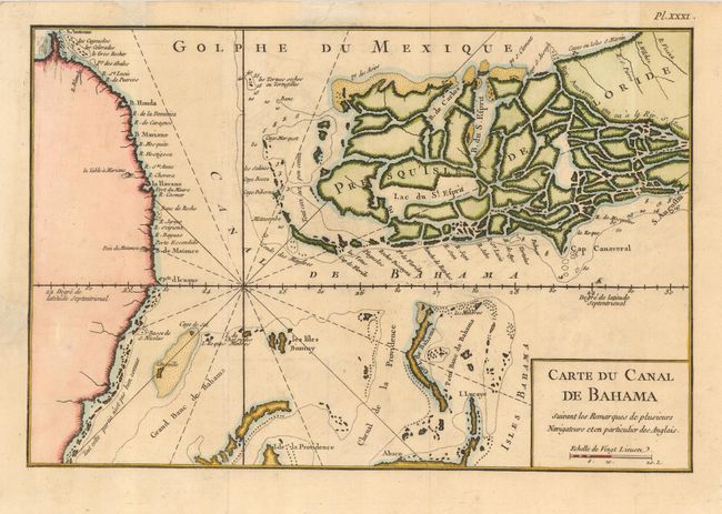
Subject: Florida and Cuba

Period: 1768 (published)

Publication: Description des debouquements…

Color: Hand Color

Size:
12.3 x 8.3 inches
31.2 x 21.1 cm
Download High Resolution Image
(or just click on image to launch the Zoom viewer)

Scarce map of southern Florida, which is depicted as a maze of islands, part of northern Cuba and the western Bahamas, including the western part of New Providence Island. The map is filled with navigational information including sailing channels, hazards, and some soundings. The map is oriented with north to the right of the chart.

References: Sellers & Van Ee #1733.

Condition: A

Issued folding, now pressed. Restoration of some paper damage in blank margin.

Estimate: $700 - $800

Sold for: $700

Closed on 12/7/2005

Archived