Catalog Archive
Auction 113, Lot 230

"City of San Francisco and its Vicinity California", U.S. Coast Survey

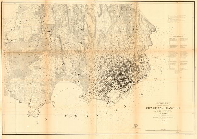
Subject: San Francisco, California

Period: 1859 (dated)

Publication:

Color: Black & White

Size:
34.5 x 23.8 inches
87.6 x 60.5 cm
Download High Resolution Image
(or just click on image to launch the Zoom viewer)

A large, early and terrific plan of San Francisco. This very detailed map is similar in title to the 1853 edition, but is a completely different map. On a scale of 6" per mile, the street and building detail is amazing with hundreds of individual houses and buildings located. Topographical detail is shown with 20-ft. contour lines throughout the map. A Table of Reference locates over 70 public buildings and at least seventeen wharves and piers are named. Map extends west to show the Union and Pioneers Race Courses, the Mission de Dolores and Rancho de San Miguel. A large and early plan of San Francisco drawn by A. F. Rodgers with the hydrography by Lieut. R. M. Cuyler.

References:

Condition: B

Issued folding, now backed with archival tissue. Toned along folds, tiny area of loss along one fold, and a little offsetting in lower blank area.

Estimate: $200 - $300

Sold for: $150

Closed on 12/7/2005

Archived